You may think that everyone has access to accurate weather forecasts today. But you’d be wrong.
Weather observations and measurements are the currency that meteorology traffics in. However, this currency is in short supply and unevenly distributed, often not reaching the places around the world that need accurate weather forecasts most. For example, in Africa, about 80% of the data from the meteorological service is unable to provide proper climate information and early warnings.
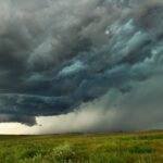
And there’s a painfully high cost for this lack of access to reliable weather forecasts.
In 2018, there were 315 natural disaster events, resulting in 11,804 deaths and over 68 million people around the world being affected. The cost was a staggering $131.7 billion in economic losses.
Here’s why access to weather forecasts is causing so much damage across the world, and how that is changing.
Deployment and Data: Problems With Traditional Weather Tools
This lack of access is in part the result of a reliance on a physical hardware deployment to observe the weather. Why can’t we just deploy more hardware? Well, traditional tools of the weather trade like satellites, radar and weather stations are extremely expensive to operate and maintain and relatively rare in developing countries.
Another issue is the type of data that traditional weather companies rely on. Most of this is repackaged from government-served outputs. One key reason that the weather can be so destructive is its wild unpredictability, which is only growing with climate change. The limitations of government data, usually regional and updated every few hours, is thus becoming increasingly evident.
If Weather Affects Everything, Everything is a Potential Weather Sensor
The good news is that recent technological advances are making it possible to tap into our connected world, and transform it into hundreds of millions of virtual weather sensors. The great promise of this “Weather Of Things” approach is that this new kind of data can be harnessed to create much more accurate and location-specific weather models than ever before.
Below are some examples of virtual sensing in action. What they all have in common is the way Tomorrow.io technology positions people as active producers of weather information.
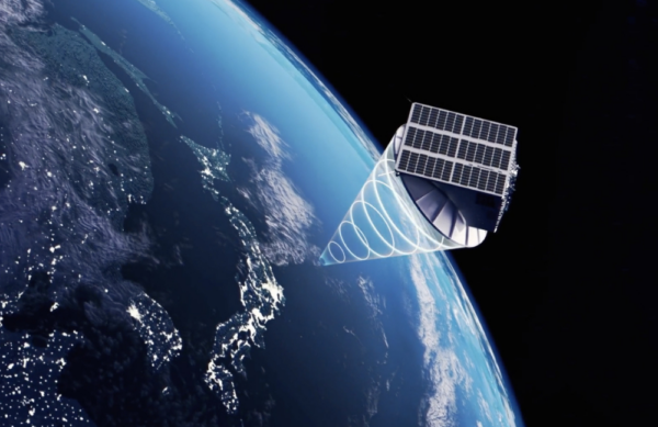
1. Microwave and Satellite Links: Across a typical city, microwave signals pass between thousands of cell towers, supporting millions of devices. Meanwhile, satellite signals are constantly beaming down and up from space, hitting every satellite TV receiver in every corner of the planet. These signals power the point-to-point networks built for hospitals, financial traders, cloud providers, railways, and many more – and are amazing new sources for weather-related data.
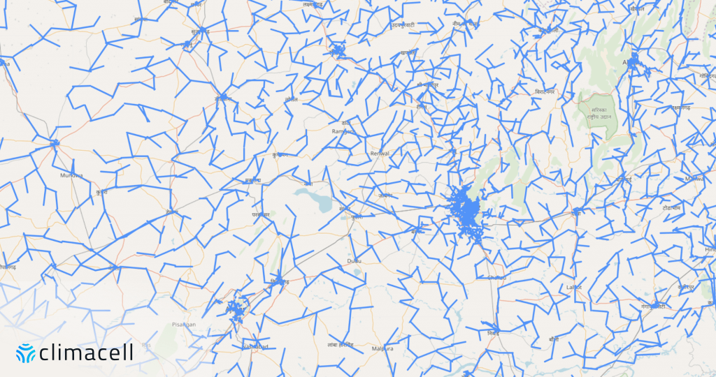
A typical cellular network topology in an area of 3000 km2, covering urban, suburban and rural settlements in India. The exact coordinates of the wireless links are randomized
2. Connected Cars: We humans are uniquely able to detect tiny, local amounts of drizzle, and turn on the windshield wipers accordingly. This is the kind of information that can give us the most accurate rain maps in the world. The ABS system can tell us how slippery a road is, while fog lights are amazingly accurate indicators of low visibility.
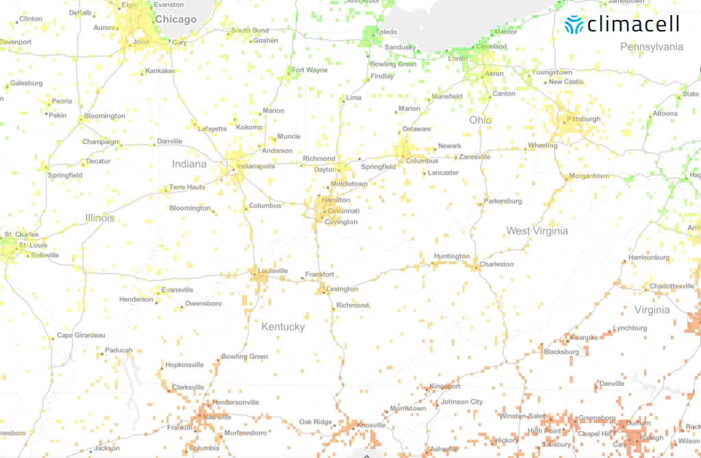
Discrete temperature measurements from over 1M connected vehicles in the Great Lakes region of the US, revealing micro-scale phenomena such as colder temperature at the coastline of Chicago
3. Mobile Devices: Tomorrow.io can, using strictly anonymized data, leverage readings from sensors inside mobile devices to access unprecedented observations about the weather. If cell phone batteries are dying sooner en masse, it may mean it’s cold outside. Also, virtual sensing technology can be used to tap into cell phones’ barometric pressure sensors to see synoptic maps that reveal hidden features in the atmosphere.
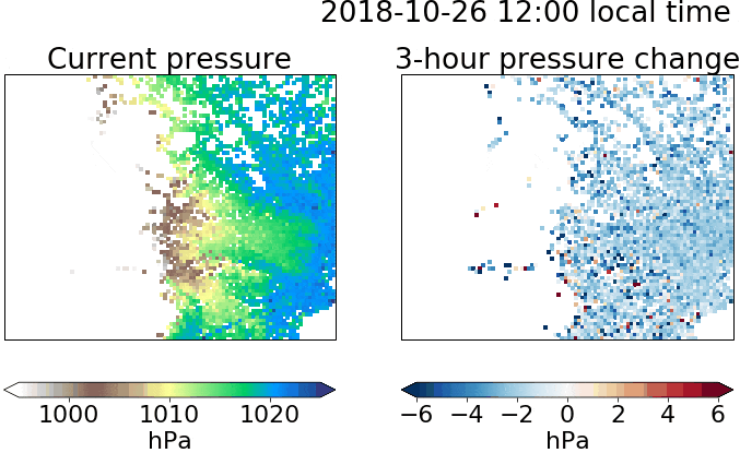
Information from a cell phone’s GPS can be transformed by Tomorrow.io into hyper-accurate weather data. Above images: mapping the changes of a mobile device’s barometric pressure
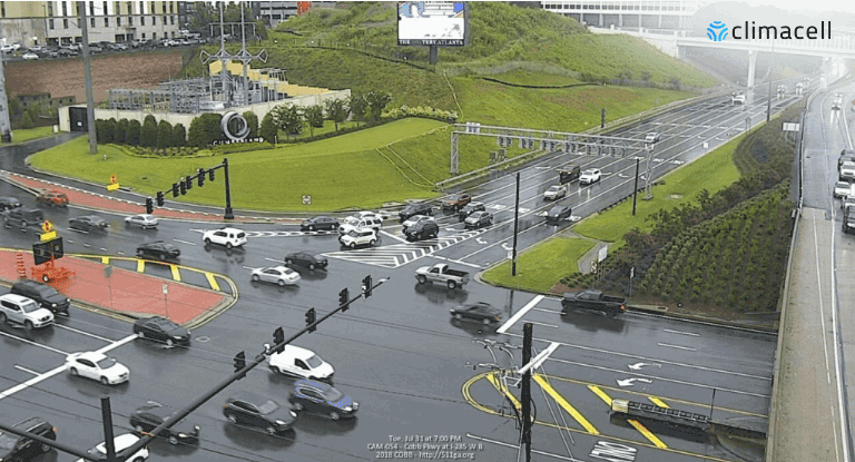
4. Road Cameras: Virtual sensing technology uses the latest in image processing and deep learning to process data from hundreds of thousands of live outdoor feeds, and soon millions of dashcams, to identify weather conditions such as precipitation type and intensity, fog, cloud coverage and more.
The Challenge: Turning Virtual Sensor Data Into Weather Insights
Virtual sensing technologies are being developed that will soon be able to tap into electric bikes, scooters, and airplanes — to name just a few. By reverse engineering data gleaned from hundreds of millions of sensors around the globe, countries that most need hyper-accurate, location-specific and continuously updated weather information will be able to get it.
Without the need to invest in and maintain costly infrastructure and equipment, people who have never had adequate time to prepare for Mother Nature’s wrath will finally be able to do so. Weather will finally be available throughout the globe — no matter where you live.